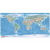
The classic political map of the world
A large educational map of the world with national borders and a basic geographical network.
Working with the map, children will better understand the phenomena and processes taking place on Earth.
Use the map for thematic learning and for developing mapping and communication skills.
The map is suitable for telling Big Stories and for key lessons in the Montessori classroom.
The marked national boundaries and geographical grid help students navigate the map. Older children will use the map for presentations.
The map is also suitable for high school and college classes and for group discussions over the map.
We print the world map on a plastic non-descript canvas with buttons that can withstand the increased load of children and can be used for outdoor learning.
| Category: | e-shop |
|---|---|
| Velikost: | 100 x 200 cm |
| Materiál: | umělohmotná plachta 100 % PES |
| Co obdržíte: | mapu, dárek |
| Prodloužená záruka 3 roky: | ano |
What exactly do you get when you order a political map from us?
A large political map of the world 200 x 100 cm
A laminated A3 worksheet that you can copy at will for classroom use
Why buy maps from MAPUiTO?
The maps excel in display quality, you will see even the smallest details and underwater relief on them.
We produce large and durable maps that children can walk, run, work independently or in a group. The maps can be hung up, so they will do a lot of work in the classroom.
Connecting geography and learning. The maps are produced by a Montessori teacher and a trained physical geographer with many years of experience in geoinformatics systems.
We invent new tools together with teachers.
Lots of free supplementary materials. We are always creating more and more worksheets for the maps, which you can easily download on our blog.
Family production for us means maximum commitment to you and attention to your requirements.
We also produce customized maps.
We care about the environment. Every month we plant a tree in cooperation with Arnika. We try to avoid unnecessary plastics in packaging and use paper adhesive tapes. We print all maps in the Czech Republic. We are always looking for more environmentally friendly ways to print maps and the material meets the Reach Directive.
We support local production. The wood we use is processed by a local company. Our product packaging is fully recyclable. We use only high quality, certified and environmentally friendly oils.
